The cemetery for the parish of St Saviour’s is within Locksbrook Cemetery which opened in 1864. There was animosity between different factions of the St Saviour’s burial board particularly about the rector having closed Kensington Chapel and the level of parish rates. At a burial board meeting on 31 Mar 1862 at which a hundred ratepayers were present, James Chaffin, a churchwarden and chairman of the meeting, was hit by the clerk, Nathaniel Cowdry, a lawyer and clerk to board, the latter having tried forcibly to stop a proposed resolution being read out. The matter went to the magistrates’ court where, after a 5 hour session which included cheers in support for Mr Chaffin from public attendees, Mr Cowdry was found guilty of assault fined £5 and costs. The press report has that ‘The result was hailed by loud applause in the court.’ (Bath Chronicle 10-Apr-1862 p3)
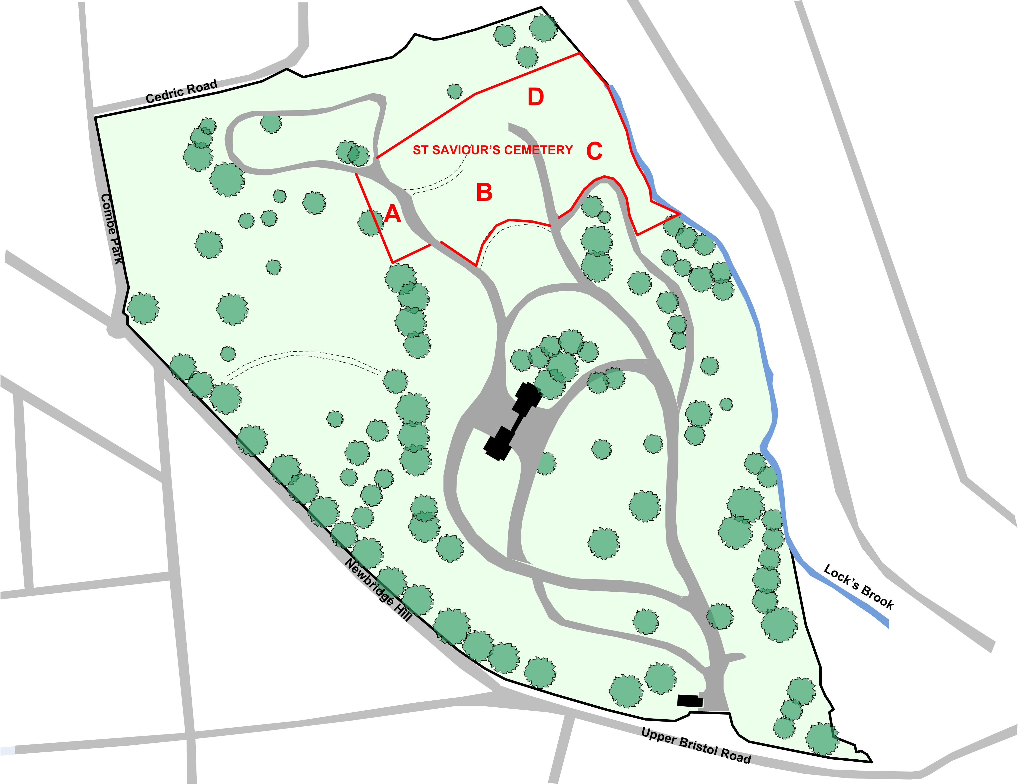 Overall layout with the area of St Saviour’s Cemetery within Locksbrook Cemetery |
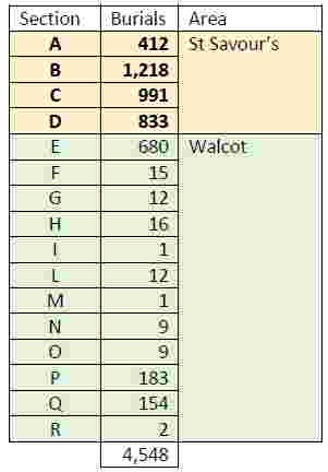
Sections A and B and the western part of Section D are relatively level. However Section C and the eastern part of Section D are on land which slopes steeply down to the Lock’s Brook which is the eastern boundary for most of Locksbrook Cemetery. As part of the agreement to develop the section to the north of the area for Weston parish some of the new land was given to St Saviour’s in exchange for using some of its land for the pathway. Sections A, B and C are consecrated. For section D about 77% is unconsecrated. Overall 85% of burials were in consecrated ground. Nearly 9% of burials have a section number different from A-D, suggesting that they were buried in the Walcot section of the cemetery. For example two burials are given as at P.B.42, both being qualified by 'Walcot'. There are over 600 burials where the section is given as 'E' but the official map has no such section. Unfortunately no memorials for such burials have been found which might have indicated where it is.
The burial registers for this cemetery were originally with B&NES Bereavement Services. Access to these registers was refused but scanned images for the burial index were provided for the cost of scanning. This index gives a chronological list of burials, grouped by the initial letter of the surname. There are two volumes, the first from the opening until 1928 and the second from 1928 to present. There were 4,550 burials. The index entries supplied have the name, date of burial, number of the entry in the burial register and location. There is no age and, where possible, this was found from the corresponding death registration. It was possible for find abodes where there was a grant of probate.
In 2023 the registers were transferred to Bath Record Office and images of the pages also became available. The original records in the Bath Burial Index were enhanced with the additional information in the burial registers including abode, place of death and occupation. Of particular use is the specification of the father and father's occupation for children.
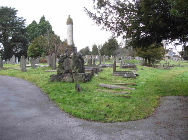 The path (on the right) leading to the St Saviour’s area. | 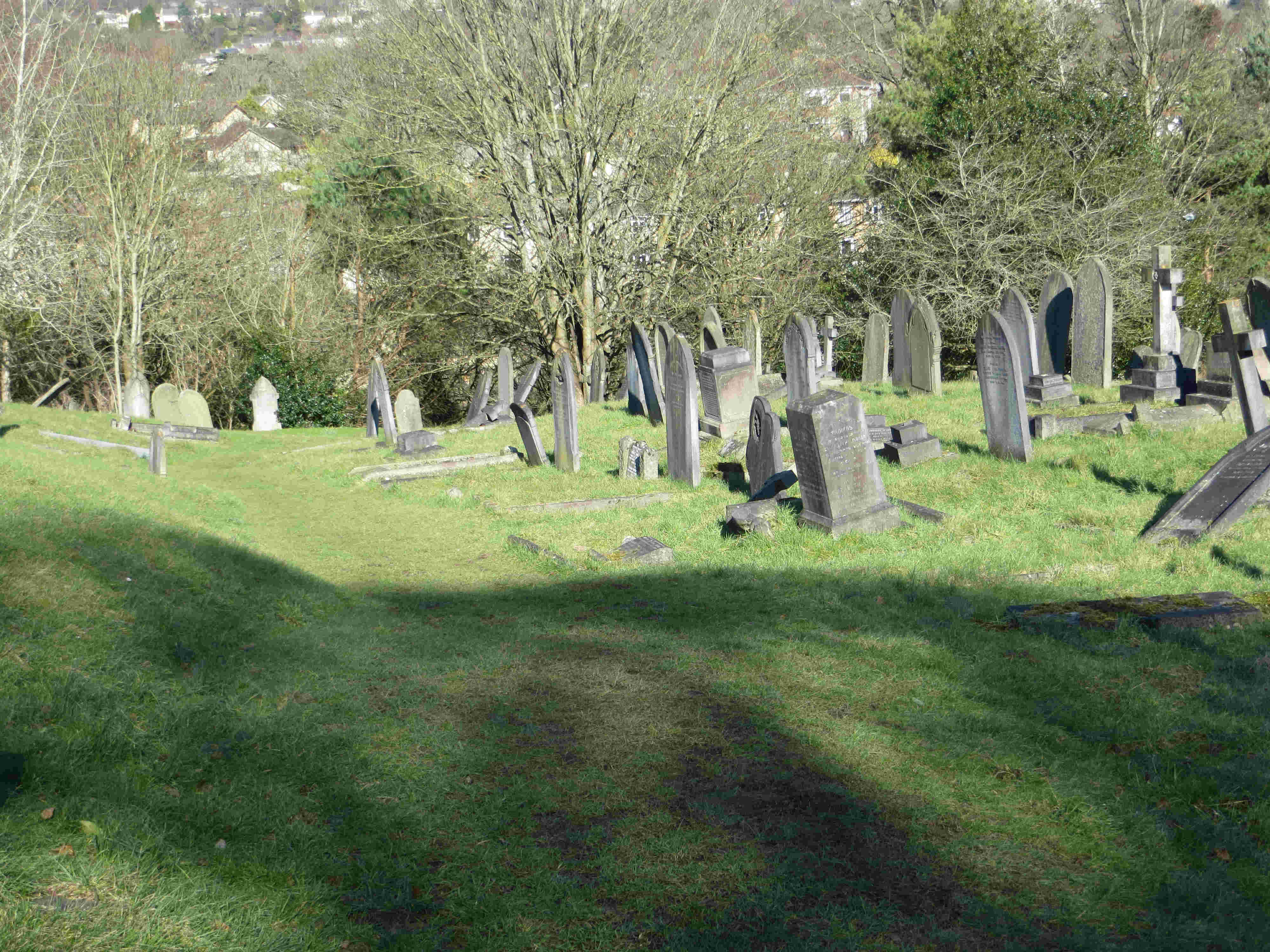
Section B from the northwest |
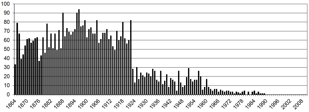 Number of burials per year |
The maps of the areas for St Saviour’s only has sections A-D but the burial locations given in the index also have other sections. The distribution of burials across the sections has 76% in the St Saviour sections A-D and 24% in sections other than these, presumably in the Walcot sections of the cemetery.
 Bath Record Office has account books that record the fees paid for burials. The entries are in chronological order. The information in those books has the name, date of burial and the fees paid. It does not provide abode but does indicate whether or not a fee was paid for a memorial. The dates of burial in the account book are sometimes suspect, as if recording the date of the payment of fees rather than the burial.
Bath Record Office has a large map of the whole of Locksbrook Cemetery dated 1871. This shows the individual sections and the numbering scheme within those sections. In contrast to other cemeteries in Bath, the numbering scheme is not a simple section, row and plot arrangement.