The parish of St Michael had the option to join with Walcot in the establishment of what became Locksbrook Cemetery. Its share of the expense would have been a sixth of the total but it decided instead to buy 2 acres of land near St John’s, Upper Bristol Road from a Miss Leir for £600. Two mortuary chapels, one Anglican the other nonconformist, were designed by Manners and Gill. The laying out of the land and the cost of building the chapels came to £1500. It was consecrated on 16 Jun 1862.
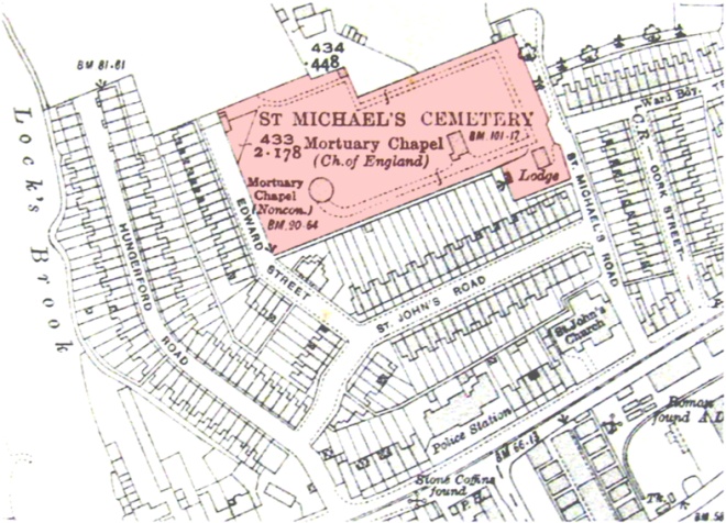
The location of St Michael’s Cemetery, Lower Weston
|
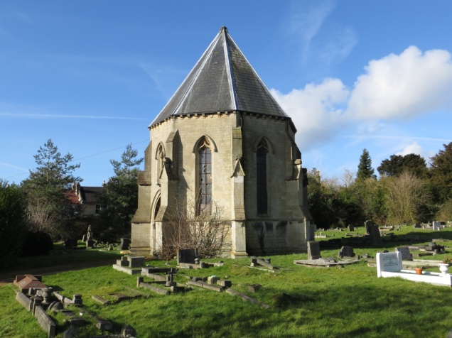
The approximately rectangular site has the graves aligned in a general east-west orientation with about 46 plots per row at its greatest extent. At the western end is an octagonal nonconformist chapel while, towards the eastern end, is a more conventionally shaped Anglican chapel with a tower. Both chapels are leased out.
Nonconformist chapel
|
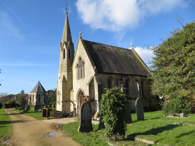
Anglican chapel
|
A large map of the cemetery is held by Bath Record Office. This has some handwritten annotations on some graves giving the surname but this cannot be relied on to find a particular grave.
The graves are arranged in a grid with rows A-Z (plus Za) for the consecrated area and AA-TT for the unconsecrated area. The consecrated area is the eastern part of the ground. The plot numbers start at 1 by the southern driveway.
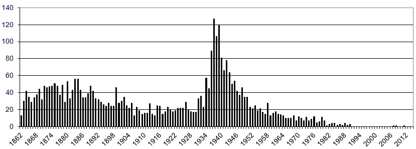
Number of burials per year
|
From The Bath Chronicle of Sat 25 Apr 1914 p3 col d: